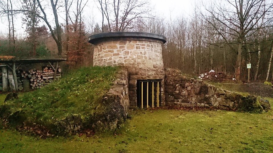
The historic gypsum kiln is located west of Neuhof on the nature trail around the Kranichteiche and was put into operation for the first time on October 21, 2006.
These meadows, which originally belonged to Sachsa, were sold to the nearby Walkenried Monastery in 1238.
The monks of the monastery created ponds here to provide themselves with fish, as they did not eat meat. The monastery rebuilt the village of Neuhof, which had fallen into ruin during the power struggles between the Counts of Klettenberg and Hohnstein, as a farm right outside the gates of the monastery.
Due to the decline in population in the 13th and 14th centuries, the number of lay brothers also decreased and the agricultural land was farmed by farmers who paid rent to the monastery and lived in Neuhof.
After the monastery was abandoned in 1668, the Duke of Brunswick inherited the monastery properties and incorporated them into a foundation. Even today, many of the lands here still belong to the Brunswick monastery estate.
The 3 km long crane pond nature trail leads from the start at the village community center around and through the three interconnected ponds. The Priesterstein nature conservation monument and the historic gypsum kiln are located along the route.
