The Köthener Hütte is located between Alexisbad and Mägdesprung on the so-called Kapellenfelsen (385 m above sea level) directly on the Selketalstieg.
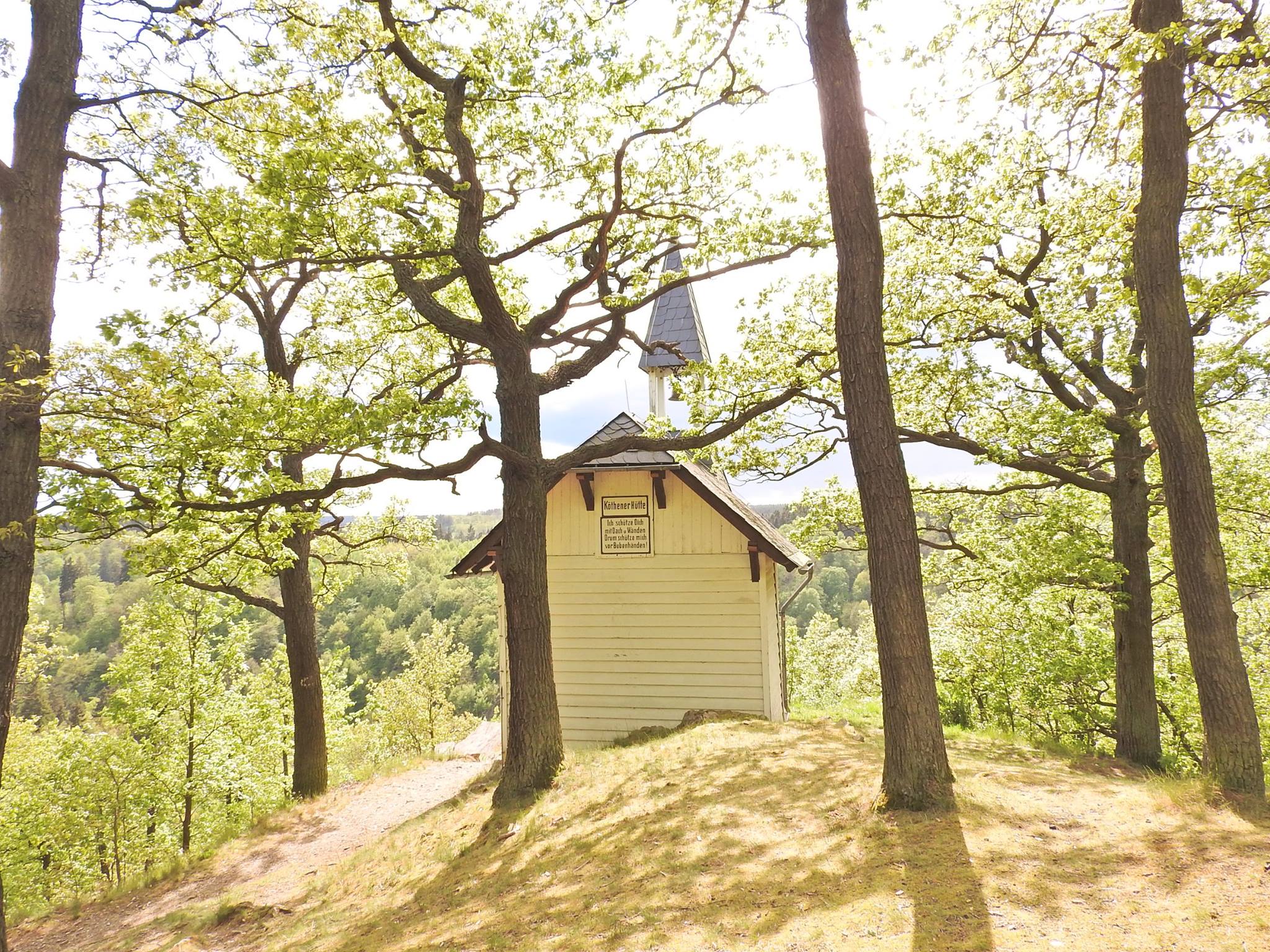
The Köthener Hütte was built in 1897 by the Köthen branch of the Harzklub and looks like a chapel with its small bell tower and white paintwork. The site was prepared by the ducal forest district administration at the time. The particularly beautiful view of the Selke valley and the Ramberg massif was made possible by deforestation. The Ramberg is the highest massif in the Lower Harz. Like the Brocken or the Oker granite, this granite massif was formed around 300 million years ago.
The area between Harzgerode, Gernrode, Günthersberge and Ballenstedt belonged to the Duchy of Anhalt until 1918 and previously to the Principality of Anhalt-Bernburg until 1863. The Eastern Harz was already a popular hiking destination for Anhalt residents at that time, which apparently prompted the Köthener Harz-freunde to build this hut.
The easiest starting point for a hike to the Köthener Hütte is the small parking lot on the left-hand side of the country road that leads from Harzgerode to Mägdesprung. From there, you can reach the Köthener Hütte without any inclines and can explore many other impressive viewpoints along the varied cliff path.
