The Scharfensteinklippe (698 m above sea level) is located southwest of Ilsenburg and southeast of the Eckertalsperre reservoir.

Below the cliff is the Scharfenstein ranger station, which not only provides hikers with information, but also offers a snack.
Around 1875, Count Otto zu Stolberg-Wernigerode had a forester’s lodge built, which developed into a popular rest stop for Brocken hikers and an excursion restaurant with accommodation in the forest settlement built around 1920.
On April 11/12, 1945, US troops occupied the Scharfenstein without a fight. They were relieved by the Red Army in July of that year. After the founding of the GDR in 1949 and the formation of the state forestry administration, organized forestry was initially resumed on the Scharfenstein.
Due to its location close to the border with Lower Saxony, the first wooden barracks were built here in 1955. The old forester’s lodge was demolished in 1960 and new barracks were built for the GDR border troops in 1969.
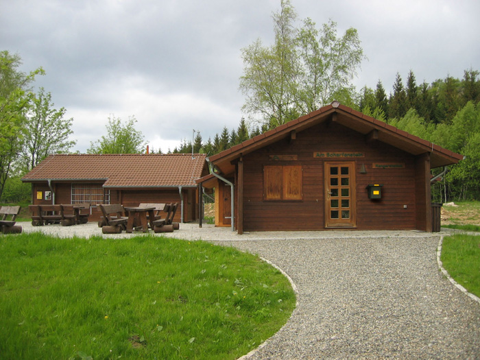
The barracks were demolished in 2000 for the renaturation of the area in line with the national park and two years later the current ranger station with two log cabins was opened.
You can easily reach the Scharfenstein from the Eckertalsperre HWN 1 or combine it with a tour from Ilsenburg through the Ilsetal and over the Kruzifix HWN 3.
