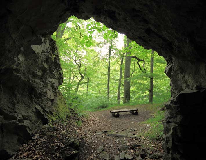
The Volkmarskeller is a karst cave located to the west of Blankenburg above the Klostergrund, approx. 4 km from Michaelstein Monastery HWN 59.
It is assumed that the cave was settled by a hermit named Volkmar in 950. His followers, the Volkmar brothers, later joined forces with the Cistercians, who had split from the Benedictine order in 1098.
It was these Cistercians who built a small monastery right above the cave in the 12th century, which they named „Michaelstein“ after their patron saint. It was also at this time that the cave was converted into a cave church. A short time later, however, the monastery was moved to its present location at the beginning of the monastery grounds.
The cave was excavated by Baurat Brinkmann in 1884–87. The cave had already been filled in so that it could only be entered by crawling. Old mortar plaster was still found on the walls and the skeletons of 3 adults and 3 children were found in front of a brick altar base. At the south entrance, 2 carved consecration crosses and a niche carved into the rock are reminders of the former sacred function.
Ausgangspunkt ist der Parkplatz am Kloster Michaelstein, von welchem man zum dritten Klosterteich wandert, an dem sich die HWN 59 Klostergrund Michaelstein befindet.
From there, follow the signposted path to the Volkmarskeller, past the memorial to the miners of the Volkmar mine who died in an explosives explosion in 1893. The stamping point is located directly on the hiking trail next to an information board. The cave itself can be reached via a narrow path approx. 30 m to the left of the stamp box.
